OVERVIEW
What Is MapIn?
MapIn is a digital solution t0 re-imagining way-finding systems within the boundary of airport environments (i.e. From parking to exit), mainly focusing on the visually impaired.
ROLE & TEAM
User research, product thinking, interaction design, visual design and prototyping.
Team - Independent academic project.
THE PROBLEM
Several researchers have identified that passengers can have difficulty navigating through airport terminals (Cave, Blackler, Popovic, & Kraal, 2013; Fewings, 2001; Tam & Lam, 2004) which can result in a less than optimal airport experiences.
The vastness and inaccuracy of information usually influence passengers’ airport experience from the point they enter the airport environment – in the parking area, to the point that they leave the airport – looking for a rental car or being picked up. There lies a problem in developing human spatial cognition through easily accessible way-finding systems.
The process

Using the double-diamond framework, I explored all the facets of a product design process to get actionable insights.
Scope of study
The process of wayfinding starts when one enters the airport vicinity with the aim of either reaching their airline check-in counter or parking their car in the vast airport parking spaces. The issue of navigation does not end when one boards a flight, deplaning, baggage collection and looking for the right exit are also added to the scope. Passengers have various pain points, however wayfinding is one area that touches each point of their experience.
Context : The airport and airline industry who are the providers and enablers of navigational issues in airports environments.
Content : The airports and airline industry will be studied to understand the factors affecting passenger traffic on airports. This understanding will be used to re-imagine the problem and provide solutions through an improved framework.
Subjects : Operational staff on airports, air-travelers, airline companies, airport management along with wayfinding technology and environmental graphic consultants.

Target audience

Problem statement
How might we re-imagine indoor wayfinding systems for visually and non-visually impaired passengers in airport environments?

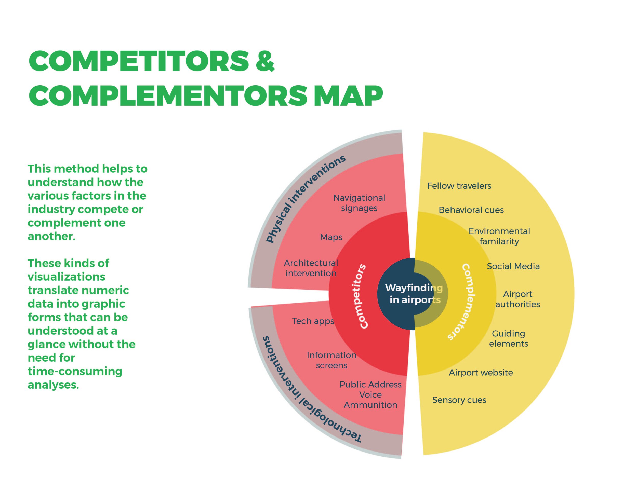
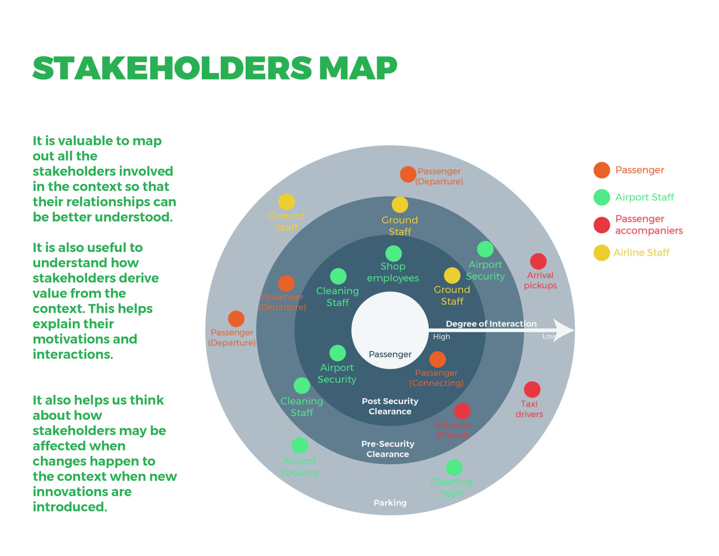
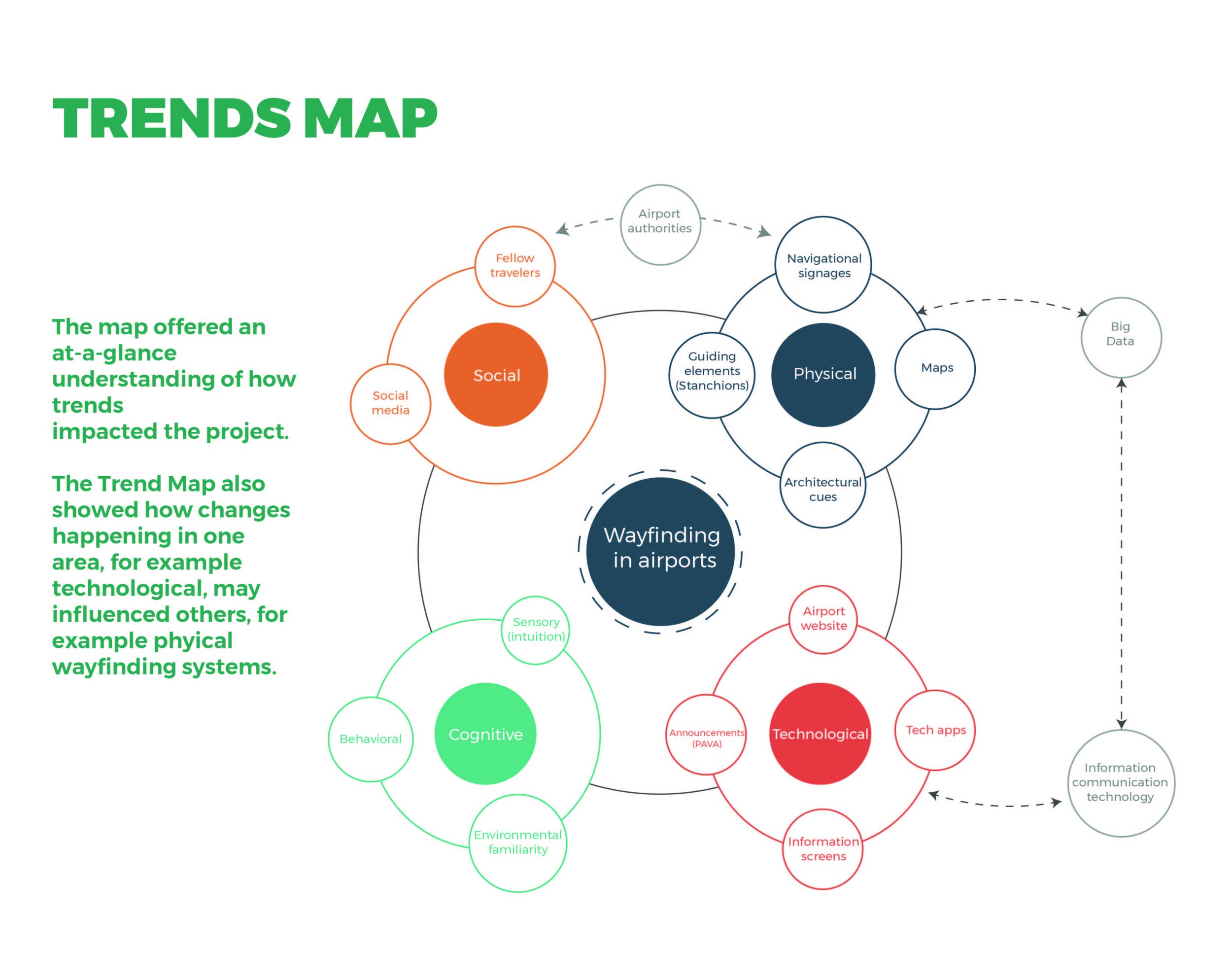
Research methods